

I found this old card showing the dock area in le Havre in a local junk shop. It's an unused card with a divided back, so it dates from after about 1910. I can confidently say it's pre-war because the Quai de Southampton no longer looks anything like that.
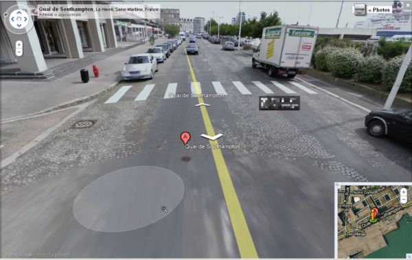
This is a Google street view of the same road. The whole area was flattened during the war, stretching for about two kilometres from the centre. It was rebuilt immediately after the end of the war by architect Auguste Perret. It is now listed by UNESCO as a World Heritage Site.


Well, times have certainly changed the area!
ReplyDeleteI like old cards like that, it's nice to know how things looked before they got destroyed. Le Havre is really a great city to visit, very different than other cities.
ReplyDelete